The
Larapinta Trail has a mystical quasi-religious aspect. Merited or not,
it’s tangible in the minds of many who make the trip to hike central
Australia’s most famous trail. A fervent light burns fiercely in the eyes of
many pilgrims, more so as they near the end of their arduous and lengthy ordeal
and feel perhaps that some of the veneration owed the Trail is owed to them
too.
It's
understandable. The Trail …
On
the other hand, there’s the locals. Like the Trail exists within an enclosed
cylinder that snakes across the landscape, a rainbow serpent keeping the
pilgrim within as a codicil to its act of creation. But holes push through the snakeskin at key locations. Big openings at the trailheads through which
locals pass with familiarity. Smaller holes at the campsites, where locals taking a weekend walk rather than the trip of a lifetime might share an interpretation of
the Trail and life in its surrounds at odds with that approved and promoted to
the long-distance pilgrim.
And
me?
Years
ago, Nick Kostas suggested I walk it. Nick has an adventure travel company with
gigs all over the globe and Larapinta is top of his Australian trail list. He’d
done it recently, testing his company’s ‘self-guided’ walks at the same time,
and expectations were exceeded. He recommended a similar trek for me.
▶ The
way out back
After
two straight years failing to get the family on board for a hike, the third
year I simply declare that I’m doing it and ask does anyone want to join me.
No-one did. At least, not until it was too late.
I
get a two-week pass and settle on possible dates (in August – at the end of the
high season / start of the mid-season – because you probably don’t want to be
hiking in Central Australia too far outside the winter respite). Realised I was
way too late to book ‘self-guided’ support and furthermore that very few ‘small
group’ spots remained available around the time I wanted to travel.
But
before sharing my credit card details with the corporation I had a chat with my
old mate Nigel, who’s lived in Alice Springs a long time. I had a mind to spend
time with him in the day/s before or after my trek.
“You
know what,” he says after we’ve talked long and meandering about anything and
everything – music, bad behaviour, old friends, lovers, Alice Springs, more.
“Fuck it! I’ll come with you … on the bits I haven’t done. And I’ll drop you
out there and pick you up for the rest. I can put you up as well. You might
have to stay in the office but come to the house for a shower and Brigitta
won’t be able to stop herself from cooking for you.”
Uh
… okay! No bookings for me. Which also means … no on-Trail support. Apart from
Nigel. Makes the trek a little more daunting. Every Larapinta webpage
emphasises how tough and isolated it is. But novice or not, I’m not going to
pass on an offer like that.
A
week or two prior to departure I prep. The old backpack bought for one of the
kids years ago ($69) I fill with stuff until at 15kg its weight approximates
that of a full hiking kit. Then with family and a visiting overseas friend in
tow, walk 14km to the top of a mountain and back. It mightn’t be as ‘tough’ as
the Trail, but that was easy. A big margin for extra exertion if required.
Tick.
There’s
a cheap lightweight sleeping bag in a cupboard somewhere, rated down to 8C.
Sure, Alice had two entire and consecutive weeks of sub-zero overnight
temperatures in June – a record – but that’s obviously not going to last till
August (!) and besides I’ll be in a tent ($67 ten plus years ago, erectable only
with one splintered pole wrapped in gaffer) and I’ve a cotton inner for the bag
(add a degree or two) and if I’m really cold, I can pull on some clothes,
right? So all set.
Not
quite. I put together a first aid kit and buy and register a PLB (personal
locator beacon). The PLB sets me back a little over $300 but it’ll last a
minimum of 5 years and even then can be fitted with a new battery for another
go round. Though before those first 5 years are up all our phones will be
talking to satellites anyway, so probably just one battery cycle. (Since Larapinta I’ve loaned it to friends taking remote
hikes and tend to carry it any time I’m going anywhere remote or risky – why
not?)
I’ve
got good Kathmandu boots, a year or so old. They’ve a softer sole than a lot of
boots, which gives me a better feel for the surface underfoot. (The downside of the soft sole is less rigidity when stepping up small ledges.) My hiking
clothes are also mostly old Kathmandu gear. Not because I shop there a lot
(which relative to other places I do) but because it tends to last. It’s
residual. Shorts and tops suited to layering – combining merino long tees with
high-tech materials. Plus many non-Kathmandu items: t-shirts, shirt and jacket,
socks and undies, water booties, and more.
A
decade ago, one of the kids went to school without a hat or lost the
one he had that morning. Not wanting to miss out on lunch (“No hat, no play”)
he grabbed one from the lost property box. An over-sized, ugly and
trek-practical hat, with a broad brim and a long rear flap to keep the neck sun
free. Of material intended to quickly and coolly evaporate sweat away. The boy’s
mother disinclined him to ever wear such an ugly thing again so it came to me
and stuck. The ugliness which may have contributed to its original abandonment
has also contributed to its boomeranging regardless of where I leave it. Shout
out to Sofia, whose name still inscribes the rim.
With
departure date approaching and me reading up on the Trail and getting both increasingly
excited and increasingly frightened, Nigel goes incommunicado. Growing concerns
about his welfare and availability are placated by a message from Brigitta on
Nigel’s Facebook profile (?) telling me not to worry, that Nigel will be around
to meet and help me out. I’m getting the sense that while Nigel is happy making
commitments for some time into the future, he’s not into sorting out the
specifics until the event is at hand.
When
I mention to Brigitta Nigel’s plan to join me on the parts of the Trail he
hasn’t already walked, she says “He hasn’t done any of it.”
…
You
know what? Fuck it. If it works for Nigel, it works for me. At this late
juncture I’m too excited to care.
Nigel
comes back online a day or so before an early flight out of Canberra takes me
to Brisbane, where the flight on to Alice Springs departs only a couple of
hours late. He’d been driving a bus through the Western Desert.
The patterns left by rainfall and run-off on the parts of western Queensland visible from the plane are fascinating
– for me if not so much other passengers. More like stains than the coursings of
water. Because the land is so flat perhaps. Flat and hard. No deep ravines, no
permanent courses gouge the landscape. More splatter and fractals. Different
colours, dry but pooling, spread across a fabric, creating an anti-pattern with
no base colour nor reference point. A consequence of coincidence in 2 dimensions.
Water lies on the surface after recent rain, lacking
the confidence to run. A course might briefly explore the surface before giving
out, no part giving direction to another. Constant variation. Here striations.
There ovals and clumps. One combination ceding to another with no compromise
and no pattern to the boundary between sets of shapes and colours. With no
visible sign of civilisation. No cleared land. No demarcations. An endless
everchanging canvas of colour and shape.
My
fringe is stuck to my forehead when I enter the terminal. Consequent of the
tendency to push forehead against window to look down. Strongest when the view
below is clear of clouds and novel of landscape.
Nigel
is waiting at the baggage conveyor but says nothing about the hair. The tall
skinny bloke I last saw, oh, thirty years ago is somewhat larger. I can get my
arms around him but won’t be able to if he grows any more.
“Slight
change of plan old chap,” he laughs. “Brigitta threw me out this morning.”
“Nothing
to worry about,” he responds to my expression of concern. “It’s the 25th
time she’s thrown me out in the 18 months we’ve been together. She’s got a
temper that girl.”
Nigel,
even more inclined than he used to be to see the funny side of things, will be
staying with me at his office. The finer details we’ll get to as we need to. “I needed a break anyhow.”
The
15km drive from airport to Alice crosses the east-west course of the Heavitree
Range at The Gap, just south of town. Nigel claims to be the last person to
ever fly between the high rock cliffs of the pass, rising several hundred
metres on either side. Last because he was sitting behind the pilot taking
photographs and because after they pulled their stunt, planes were expressly
forbidden to ever again fly through it at low altitude.
 |
that's him!
|
He’s
done (or claims to have done) many things in Alice over the last 25 years, some
of them work. Been a photographer (buy a postcard in Alice and there’s a
reasonable chance it’s his credit for the image), a graphic artist, a painter
and lecturer of fine art, and a video and music producer. He and a mate have
long operated a printing business (cum occasional temporary residence). Between
other gigs Nige drives a bus for the NPY Womens Council, moving folk between
the regional centre at Alice and aboriginal communities upwards of a thousand
kilometres away. The
offices of NT Print Management / Recycled printing share an industrial
cul-de-sac with a refrigerated products entrepot, a truck repair workshop, a
fresh water delivery depot, an air-conditioning maintenance centre, a tyre shop
and a wholesale steel supply warehouse. Not Club de Mer then.
 |
the view
|
No
five-star habitation either. Nige has swept it out and vacuumed and cleaned the
parts of the bathroom that can still be cleaned (thank you), but it’s unlikely
to pass any standards check.
Hard
to believe but I have not spent a night without a member of my immediate family
nearby in more than eleven years. I’m off the leash, freed of all parental and
familial obligations for the first time in over a decade. I’m gonna be stoked
wherever I’m staying. In fact I’m going to be irrepressibly happy and excited
and expect to stay deliriously so for the duration of my holiday.
Nigel
thinks it’s all pretty funny too, but he does that.
The
print stock storeroom on the right will be my abode, the bed a foam mattress
Nigel pulls from a shelf and throws onto the floor, one that’s seen better days
and is only used for camping. I pull sleeping bag from suitcase and throw it on
top.
Nigel
will stay in his private office, where workdesk and a selection of musical
instruments share the floor with a regular double bed mattress.
A
cabinet displaying antique cameras and NT Print Management products (including
the flagship range of postcards, available at wholesale prices in volumes of
500 or more), a rock-and-succulents garden, some sagging lounge furniture, and
a bunch of stuff discarded by other people – PA systems, road cases, various
other large outdoor peformance components, and so on – decorate the reception
area.
And
art. Nigel’s wonderful naïve artworks of central Australia share the walls with
works other have gifted him. More artwork leans stacked against the walls.
The
kitchen has a mini-fridge, a hotplate, cold running water and a dubious
selection of utensils and foodstuffs. Breakfast cereals, like everything else,
are kept either in the fridge or in sealed plastic containers. Because …
The
bathroom … the shower runs pretty much continuously and not out the nozzle. For
reasons I don’t understand Nigel can’t fix it and the landlord can’t be
bothered. The walls around the outlet are falling away. It’s useless as a
shower though the drain still works (all the time in fact). Washing is by means
of a bucket of water warmed on the hotplate and brought from the kitchen. The
towel racks fall off the wall. I can hang a towel on the fittings if I want to.
I don’t.
Base
camp established. Now what about the Trail?
Section
One of the Larapinta Trail begins just three kilometres north of Alice at the
Telegraph Station Historical Reserve. We head to the Reserve late in the
afternoon. Tomorrow, Wednesday, I’m to attempt Section One as a day walk. Nigel
is concerned it might prove tougher than I expect and we head out to the
trailhead for a familarisation. Through the Telegraph Station precinct, along
the Todd River (there’s a waterhole or two), up Trig Hill where a German
backpacker sits cross-legged facing the forthcoming sunset, and back around via
the commemorative gravestones of some tough old bastards who died nearby. We
pass a woman friend of Nigel’s, the manager of the facility, out for a walk.
She’s Covid-positive and keeps us at a good distance. Even at a distance she
manages to place a verbal order for a selection of new release postcards.
Everywhere we run into people from one or other aspect of Nigel’s life.

Driving
back we pick up a young Israeli, hitchhiking, dehydrated, disoriented and short
on accurate information and realistic understanding of the immediate and/or
wider world. One of those people who just blank out when confronted with the
larger part of reality that doesn’t conform to the Israeli state-approved
interpretation of the world. Nigel delivers him to the door of the house he’s
staying at, a kind of Israeli outpost in the red centre.
Given
the extent of support I’m getting from Nigel, I endeavour to pay for food,
meals and drinks whenever the opportunity arises. The Todd Tavern becomes our
regular. The only other patrons in the dining room when we arrive are two more
of Nigel’s female friends, workmates from the Women’s Council.
We’re
back at base camp in time for an early night.
▶ Section
One
Well
before dawn I’m dropped as close to the trailhead as Nige can drive. The gate
to the reserve is still locked. While I’m pulling on my backpack a ute stops in
the middle of the road and its uniformed occupant rushes round the gate and
into the darkness beyond without acknowledging our presence. Following her into
the black, I’m overtaken by a woman on an electric scooter and cross paths with
a jogger making his way back towards town.
At
the trailhead I’m alone. Peak season, early morning, I’d expected small groups
gathering in the dark, assembling kit and making final preparations for their
epic journey. But I’m alone.
Wonderful.
And apprehensive. Section One is a 25km Grade 4 walk (on a national system that
rates walks from 1 to 5) and the guide recommends two days to comfortably
complete. To meet Nigel at Simpson’s Gap at 3pm, I need to average over three
kilometres an hour including breaks. Better get moving.
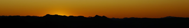
Sunrise is spectacular. The eastern sky covered with
low cloud, grey with the oncoming dawn lighting puffy fringes red, slowly
turning pink, like the down of a Major Mitchell cockatoo. Silhouetting the
furthest ridges of the Macdonnell Ranges across a gentle valley to the east,
while the clear sky to the west turns through dark to blue.
The morning weather is kind. A warm night with the
cloud cover and the sun not breaking through until after 11. Early morning
chill dissipates as warmer air gently shifts off the surrounding stone. By
early afternoon the wind has picked up and is funnelled at high speed through
gaps in the landscape. At Hat Hill Saddle some seven hours later, I leaned into
a 50+kph wind with arms out and shirt pressed hard against my body. Once the sun emerges the temperature climbs towards 30, well
above the forecast 18.
Beautiful and peaceful to be out and walking as dawn
breaks. Intermittent spiderwebs wrapped across my face confirm there’s no-one
in front of me. Expecting to be overtaken by organised groups of fit young
people in fact I see no-one travelling my way all day.
Initially the landform is of soft hills, small trees,
shrubs and grass, and the path is easy. The shifting growing changing early
morning light amplifies the constant change of landscape, with diverse rock
forms pushing through and jutting out and ground cover varying in
response.
An eagle hovers above for some minutes before flying
away, disappointed I’m not yet dead or dying.
Over the course of the day, 15 people pass going the
other way. The first 13 all in a half hour window, suggesting they’d shared a
campsite the previous night. A hardcore couple well into their 60s lead them
and pause to chat while I take a break at 2 hours in. They’re on their 20th
and final day, having walked unassisted (bar a single food drop) from the far
end of the Trail. Amazing. They’re happy to share useful information with the
newbie – granting me some cred perhaps for being out early and on my own. They
endorse my approach – to work into hiking the Trail by beginning with a long
day walk close to town.
A large group of t-shirts asserting “100% wilderness”
are accompanied by a guide with walkie-talkie. After them, three people who
look like Nick’s self-guided types. Other members of their group had skipped
the last camp night of the hike, opting for an Uber from Simpsons Gap back to
town.
All bar the older couple were brimming with the
transport of completing their great penance. Only at the very beginning of
mine, I have no intention of staying the course. Nick’s advice had been to pick
out the best bits and visit as many as I could. The guide suggests a minimum 16
days to hike all 230km and I only have 12.
Four hours in, I cross the sheer red quartzite clifftop
of Euro ridge – jutting up in opposition to a long line of matching cliff atop
the Heavitree Range, five kilometres south across a valley divided into
irregular patches of slightly higher ground. Patches delineated by trees following
any potential watercourse. I found myself very close to the cliff edge and
discover I’d strayed from the Trail. Like hundreds before me, given how worn
and obvious the path I followed was. Good view though.
Down off the Ridge is Wallaby Gap, halfway point of
Section One and recommended campsite for the two day walk. The water pooled in
the Gap is thick and green and still, and insufficient for swimming or even sitting
in. A tank at the campsite is regularly replenished with potable water. Good
spot for lunch and reflection.
I’d headed off in a rush in the early morning dark,
nervous about finding the path, not being late, not getting lost. Didn’t even
take photos of the spectacular dawn. I took breaks at set km marks (the trail
is very well marked in both directions, with each km delineated). By Wallaby I
was so far ahead of schedule that I slowed down, took more diversions, more
photographs.
Onto Bloodwood Flat and the rest of the section (bar
the final 2-3km) traces the bottom of the West Macdonnell Range ridgeline.
Detours lead from the main Trail up towards gully lines below which water cascades
into pools in the shadow of the rock. Prettiest amongst them Fairy Springs.
Here in the shade were a
couple, 30ish, serious experienced walkers, hiked from
the far end in only 12 days. They planned to pass their last night at Wallaby
and were disappointed to hear of water insufficient and unsuitable for
swimming.
The final kilometres climb up onto Rungutjirba ridge
for views back across the flat and forward to the spectacular country to come
in Section Two.
Looking down I chanced to surprise a marsupial mouse. Small,
tan/grey on top, white/pale underneath, long tail and moving like a kangaroo
rather than a rodent. Two hops and it dives into a deep dark cavity between the
rocks.
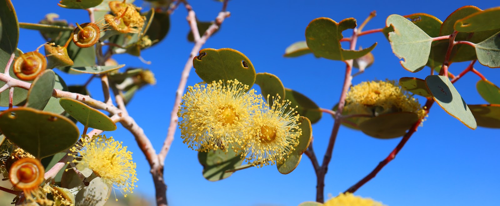
The terrain is abundant with wildflowers,
predominantly crimson and purple flowers on the bushes, and tiny red flowers on
creepers spreading across the ground.
Rounding Hat Hill and there’s Nigel, walking up from
Simpsons Gap. In his hand a camera with long lens. Away from town, away from
work, and the camera is omnipresent in Nigel’s big maw. Fitted with his
favourite lens of the moment, alternates close at hand.
He hadn’t expected me so early and planned to walk
further up the Trail but when I offer that we do that together a while he
declines. In fact has a rest before heading downhill.
Once a prime central Australian tourist spot,
Simpson’s Gap still attracts a slow steady stream of visitors. The opening of
an airstrip proximate to Uluru and social problems in town have diverted
traffic away from Alice Springs, reducing visitors to nearby and amenable
locations like the Gap.
When it rains, a broad riverbed directs the gathering
floodwaters through the Gap. When it’s dry, sand turns white in the sun and the
gums, trunks twisted by the torrents, suck deep into the riverbed in search of
succour.
Where the rock cliffs of the Gap come closest together,
water is a permanent presence. Deep and cool, the pool is tantalising and
inviting. Numerous signs make strenuously clear that swimming is verboten.
Small dead fish lie on their sides on the edges of the pool, having succumbed
to a completed lifecycle, not some water borne contagion.
Day One complete. I’ve passed my exam. Caught an
amazing sunrise, traversed diverse landscapes and enjoyed large and spectacular
views ending with Simpson’s Gap.
Next a shower (of sorts) and a meal.
▶ Heading West
‘Slight change of plan old boy,’ says Nigel, on the
route back to Alice, the one that hasn’t been closed by a grassfire. Thick
plumes of smoke climb the distant sky.
He’s not going to be around for the next three days.
Instead he’s been hired to take a busload of Indigenous women from Alice to
their home community and bring back other women from another community. Three
days of near constant driving through the western desert, 1400+ km of it on the
dirt. But … there’s a but … do I want to come? One night camping out, one night
in a government camp, a trip across the APY lands and three Australian states.
A visit to Surveyor’s Corner thrown in too.
Don’t I need a permit to cross the lands? Yes but … another
but … Nigel reckons his back is playing up and he might need someone to help
out with loading and unloading. And besides, this is the NT, it’s not fucking
Canberra. I can live with that. Thanks Nige.
 |
| Coming? |
Thursday
morning we head south, toilet break at Ghan, then turn west. One of the women
insists on stopping for me to take a photo at the Mt Conner lookout. Nigel
agrees because I won’t get an Uluru drive-by on this route and Conner is almost
as good. The stop includes a close up look at the salt lake concealed behind
red dirt dunes far side of the Lasseter Highway.
A
few klicks further and 350+ km from Alice, we turn south off the highway and
head for the South Australian border and the lands.
Aṉangu Pitjantjatjara
Yankunytjatjara (APY) lands occupy a vast semi-arid desert region in the north
west of South Australia. Created in the early 1980s as a consequence of the
movement to recognise in law aboriginal title to lands occupied since prior to European settlement.
A harsh environment with little
capacity for human life. Even with support from outside the population density is
only around one person per 44 km2. Many communities that sprang up
with enthusiasm in the 1980s have since emptied out.
A dingo pup runs out in front of
the bus, looking back over its shoulder, curious and alert to our presence. Big
enough to be out on its own it cuts back into the long grass as we get close.
Still curious, the dog pushes up repeatedly onto hind legs, muzzle head and
paws briefly rising above the grass, until flopping ears chase it back into the
safety of the surrounds.
Crossing into Western Australia,
we drop the women in Wingellina, grab meals from a mining camp and head into
the scrub to drag fallen timber into a fire, eat, play guitar and sleep under
the stars. Nigel in his swag. I pull out the mattress and bag from base camp. Early
morning, a wander through the scrub turns up fresh camel tracks – ships have
passed in the night.
I get to be a ‘tourist’ with a
visit to ‘Surveyor Generals Corner’ where the boundaries of Western Australia,
South Australia and the Northern Territory meet. By draping myself over the
marker stone I can be in 3 states at once. Some 30 or so metres from the
Surveyor Generals Corner is the other Surveyor Generals Corner – an older
marker the location of which was disputed by South Australia, triggering an
adjustment. Space is not exactly at a premium out here but there you go.
Without passengers on day two, we
stop as often and wherever we please. Wander through a long abandoned stockyard.
Every piece of industrial manufacture – metal poles, corrugated iron, whatever
– found its way here on a camel’s back. So everything is restricted in length
to about two metres – lots of short pieces of metal roofing rather than fewer
longer ones.
On my sole day on the Trail, the
first several kilometres out of Telegraph Station followed the course of the
old telegraph line. The poles of which are telescopic – delivered with the top
half concealed in the bottom to be drawn out at installation – to keep them
short enough for camelpack. The line was regularly broken by the indigenes, who
would knock over poles then remove glass and ceramic insulators to smash for
the sharp edges this produced.
Car wrecks festoon the roadsides.
Some relatively modern models but seventies and early eighties models are
prevalent. Another consequence of land rights. People returning to the lands of
their ancestors did so in cars. Out here: no mechanics, no spare parts. Cars
stripped down as accidents and age took a toll on doors, windows, panels. When
they ran no more, cannibalised. Those still moving show great ingenuity amidst
the missing parts and adaptations. Kind of Mad Max without the aggro. As cars
break down a final time, they’re abandoned where they stop, often in the middle
of a road. Whenever the road is graded, road building machines scoop up the
carcasses and toss them ten, twenty, a hundred metres to the roadside, where
they’re less likely to be collided with.
The old bodies stand nostalgic,
juxtaposed against the scrub, the dust, the red dirt.
Today we’re heading mostly east,
towards overnight accommodation at a government site. Only Nigel is authorised
to stay but he sneaks me in and I’m back to my mattress and bag, this time on
the floor of his onsite. But there’s a shower, an actual shower, not just a
bucket of hot water and ladle.
As evening sets in we walk a
couple of hours out of the camp through fields of spinifex and over rock
formations that shelter other life-forms, giving them the chance to flourish. A
couple of wallaby stand well disguised at a considerable distance further up
the hillside. Taking no chances with humans.
Early start on Saturday. Possibly
too early as few souls are about when we pull into Kaltjiti, and those already
ambulant cannot point Nigel towards the parties he is to transport. The nurse
at the community health centre sorts things out, locating and prepping the
women for their trip to town.
Heading east through the lands and
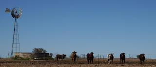
on into cattle country, passing through an odd herd of ferals – a mixture of donkey
and horse. Stopping to chat with a large and colourful family on the side of
the road, initially to check they’ve not broken down and then to let the women
talk and renew connections.
Endless landscape shifting and yet
the same – scrubby trees, close to the ground, mix of greens, the red of the
sand that passes for earth, dark lines and shadow where the rocks break
through. An otherwise straight road twists one way then the other to cross the
occasional dry watercourse.
 Many old-time cattle station
owners established ‘roadhouses’ on these routes, as way stations for travellers,
with stores that exploited local populations. Today most are derelict.
Many old-time cattle station
owners established ‘roadhouses’ on these routes, as way stations for travellers,
with stores that exploited local populations. Today most are derelict.
The dust, it’s so
fine, especially when filtered through the bus’s AC system. Gets into clothes in a way that normal
dirt doesn’t, really deep, right into the thread of things. And up my nose,
clinging to mucus to form a hard shell that rips off skin as it comes off.
Roadtrains up to 50 metres in
length whip it up as they barrel through the landscape, creating their own
biomes. Many small outback towns require the trucks to halt at their perimeter
and wait there for dust to settle before trundling through.
Late afternoon we hit the asphalt.
No-one wants to stop at the Ghan roadhouse or anywhere else for that matter
with town only another couple of hours away. The networked world pours in. The
radio comes alive with music that pleases the passengers. Days of messages and
emails cascade over intermittent network coverage.
▶ Trephina
Gorge
Back at base, I’m hankering to get
out on the Trail. Sunday will be my fifth day with only one spent hiking. Nigel
has other ideas. Surprise. A Sunday hike around Trephina Gorge, an hour east
along the Heavitree Range, where he wants to capture images for cards. He has
work in town on Monday (I can take a ‘cultural day’) but commits to walk Section
12 of the Trail with me on Tuesday, with Sunday’s hike to serve as practice. Once
that’s done, Wednesday morning Nige will drop me at one end of Section Nine and
late Thursday pick me up at the other. Come Friday, starts a four-day stretch
on the Trail that sees me through to the eve of my departure. That works.

At the gorge we climb a track that
zig-zags up steeply from the creekbed to panoramic views of both gorge and
cattle country to the north. Then amble back down a gentler slope and through
scrub recently burned. A camper had thrown bbq embers onto the ground to
extinguish them. The fire escaped and spread. Stupid fucking humans.
A second loop takes us up and
across the other side. At the bottom of a rocky gully a couple coming from the
opposite direction discuss in French how hard the rest of the loop may be and
whether or not to turn back. I reassure them that none of it is as hard as this
particular gully. They seem stunned that someone might speak French
with them out here and I have to extricate myself and push on before the limits of my
linguistic skills and local knowledge begin to grate. We also cross paths with yet
another couple of local women Nigel is very popular with, workers from a
wildlife reserve southwest of Alice.
Everyone but me knows museums are
closed on Mondays. Even so there’s plenty to do at the Araluen Cultural
Precinct – art and crafts, gifts, and the Central Australian Aviation Museum.
The precinct is built on the site of the town’s original airstrip. Given the
vast distances of the outback, air travel plays a big role and the mishaps and
adventures plentiful.
▶ Section
Twelve
Mt Sonder rises up close to 1400m.
The return walk to the peak marks the far end of the Trail. After a two hour
drive from Alice, we’re later than most to set out. Minutes in and we’re crossing
paths with folk already finishing what’s described as a five and a half hour
walk. Some ascended in darkness to breakfast on the peak at dawn. Others had run the
entire mountain, up and back, in as little as two hours. One amazing woman clad
in a camo catsuit springs from rock to rock and still possesses sufficient
energy to smile at our self-deprecating witticisms regarding her athletic
prowess.
We won’t be up and back in two
hours. The first 2.5km are the toughest, steepest, rockiest of the route, going
more or less straight up the southern face to the saddle of a ridgeline that
runs gently up the mountain, bar one steep section just short of the summit.
With the bright “good mornings” of
the breakfast club behind us, we make our way up. We stash excess food and
water on the side of the trail to retrieve on the descent. Once on the saddle,
spectacular views open both north and south. Thirty km southeast is Tnorala,
the remnant of an impact crater rising steeply from the desert floor, formed
when a comet 600m wide crashed into the surface 142 million and some years ago.
Scientists reckon the rim once stood two km above the surrounding landscape –
making it as high above sea level as any contemporary Australian land
formation.
The land is green and abundant
after two wet winters. With the onset of spring the wildflowers are bursting
out, though peak wildflower is still weeks away.
Despite frequent photographic
interludes we summit in not much over an hour longer than the advertised duration. Going down should be easier. While we take a long lunchbreak other climbers
come and go, including one delightful young woman who lunches with us, a
geo-engineer just finished her degree, out to see some country before taking up
a graduate position. She reckons a modern geo-engineer is almost entirely
working solutions from imagery delivered to the desktop computer. Better a
digital nomad, maintaining contact with the land she works.
Sonder is one of the highest peaks
in the NT, giving clear views of others including Zeil to the west and Giles to
the east. I’m particularly taken by the exposed cliffs of the range to the
south – concentric halfcircles of rock as if deliberately placed side by side
with vegetation growing into gaps accentuating the curves.
On the way down Nigel simply runs
out of gas. I load him up with protein but to limited effect. He’s running
through the water too and breaks become more frequent. I’m carrying everything,
even the camera. The further we go, the slower he gets. The less he talks. The
smile is gone. The long steep section back to the valley floor is torturous.
Long drops at every step and many small unstable stones. Back at the car after
nine and a half hours, the sun is setting and Nigel silent. I drive.
The famous swimming hole on the
Finke River, a few hundred metres from the Glen Helen hotel, is deep and cold
but it’s already dark and cold and furthermore a swim at this juncture doesn’t
fit with the hotel’s agenda.
Nigel has
history with this institution but it’s recently been incorporated into a
national chain and his connections are lost. Instead, under-staffed backpackers
service a fully booked facility with overtly rigid adherence to the corporate
playbook of an absent boss. It’s service as advertised for as long as you’re
the guest as conceived. We get a room with a hot shower – running
water that recently departed the premises of
the water supply company adjacent to Nigel’s office, transported in a tank on the back of a truck. Bizarre. We’ve come a long way to cross paths, the water and I.
I order dinner for two while Nigel
showers else the dinner ordering window will snap closed and he’ll go hungry.
We eat, consume a beer, return to room. Nigel instantly asleep on the queen bed
of our family room. After prepping my backpack and gear for the morning I fold
myself into the lower of two bunks.
▶ Section Nine
Nigel’s not quite back to his
normal self by breakfast time but his appetite has returned. Fortunately it’s a
buffet. We depart with stomachs full and pockets stuffed with fruit and
biscuits. His mood fully restored by the time we get to Ormiston Gorge,
starting point of both today’s hike and the Ormiston Pound walk.

The circular Pound walk climbs above
the high red-rock walls of the gorge and returns through its deepest part and
the water therein. The walls are spectacular and birdlife abundant, drawn in by
the permanent presence of water. Water-birds strut on rocks turned grey by exposure
to water. Ghost gums cling to the edges, pushing up wherever the sand is deep
enough that they can take root. Occasionally finding purchase on the walls
above. We pass an hour photographing and talking while Nigel recounts the near
disaster he and Brigitta experienced on the Pound: after a late start and
further delays, having to ford the gorge in the dark, camera gear aloft, emerging
into a mid-winter night, cold and wet with nothing to look forward to but a 90
minute drive home.

I don’t want my two day hike to
begin holding a 20kg pack above my head as I negotiate a water crossing. Assuming
I got through without a disaster, then heading waterlogged and cold into what
the guide describes as possibly the Trail’s most difficult section. Instead, once
Nigel’s has his fill of birdshots and takes his leave, mumbling about a photographic
assignment to Kings Canyon, I follow the Trail east as the gorge opens out.
The trail runs parallel to the
road in for 1.5km and for a short while serves day trippers on the Pound walk as
well. As it curves away from the road and the day trippers veer left up a ridge,
I’m alone.
This is it. Finally. More than a
week after arriving in Alice Springs I’m out, alone, with a loaded pack and loaded
anticipation.
It’s hard work, slogging through
creekbed sand along Ormiston Creek or following the undulations of its narrow
banks as the gorge cuts through the range. The weight of a two-day water supply
in my pack makes its presence known.

The Larapinta Trail from its start
near Alice Springs to the end at Mt Sonder runs east to west through the
Tjoritja or West MacDonnell National Park, mostly within the confines of two
ranges – the West MacDonnell Ranges to the north and the Heavitree Range to the
south. At Ormiston Gorge the ranges intersect, before running further west to
Mt Sonder and beyond. The Trail to the west is mostly south of the combined
range along the course of the Finke River, diverting to climb some of its
peaks. This morning’s walk east begins immediately south of what becomes the
Heavitree Range. The Section then climbs steeply to the range top, before
dropping through Waterfall Gorge into a high narrow valley and continuing west until
eventually descending the range south through Inarlanga Pass. I plan to stop
for the night on top of the range and on Thursday follow the Section to the far
side of Inarlanga, then continue further south for an afternoon rendezvous at
the Ochre Pits.
At the top of the steep climb I
walk alongside another hiker, a schoolteacher from Western Australia taking a
year off to hike Australia’s most famous trails. She walks with hiking poles
and on the broken rock surface these prove her undoing. One pole jams between
rocks, causing her to stumble. The other catches as she tries to rebalance. Short
wrist straps prevent her from disconnecting with the poles and, with arms trapped
at her sides, she falls straight forward onto the broken surface. It
would be funny except it’s not. I help her untangle and pull her pack off.
After a few moments face down, she sits up and is basically okay, stunned. Lucky:
no major cuts or bruises, just a couple of places on her face where skin has
broken.
At the Hermits Hideaway campsite,
hidden amongst the trees a kilometre further on, her walking companion, another
teacher, administers painkillers and more intimate sympathy.
I’ve brought no tent. Just the
fly. Because I wanted to keep weight down. Section Nine requires carriage of
two days water supply as there’s none available en route. My new friends find
this mysterious and funny. Given my newbie status, they take charge and find me
a most protected spot, up against a rock wall. What am I going to do if it
rains, they ask. I expect the fly to keep the water off. If it fails, or if it
rains so much that water runs under the fly, the worst outcome is I’ll be wet,
warm and wet. What about mice? Mice? Apparently some campsites are plagued with
them.
Given a while, but I have a while,
and a few sticks, of which there are plenty, and my fly forms a satisfactory
and slightly sturdy state. It will do. I hope. Next time bring a tent.
As Hermits Hideaway fills with
hikers I wander. With steep rocky cliffs north and south, it’s back the way I
came or forwards. Forwards takes me by the recommended overnight campsite beneath
Mt Giles lookout, where there’s only one camper. Seems like almost everyone’s
opted for the smaller more sheltered site. Bizarrely, this lone camper hails
from the same small part of WA as my two new friends. I walk back with him to
introduce them. WA is only weeks out of Covid isolation, which explains the
numbers, but so many from one small place?
Hot food is a funny thing. I have
no burner and planned no hot meals – felt no need. But when others around have
hot food, it tugs deep inside. Not something I’ve experienced before and not a
big deal, but definitely a thing. One of the teachers insists I eat half her hot
dinner – she has made a lot, explaining that she’s as new at apportioning home-made
dehydrated meals as I am at hiking. I reciprocate with Clif bars, which are
very well received. My healthy stock serves as both de facto currency and friendship-sealer
on this and other occasions. Above the rock wall behind my construction, clouds
darken with the sunset and teacher practices her evening yoga.
A light wind rises overnight, bringing
some rain. But my abode stands firm and the only water inside springs from an
accidentally punctured bladder. Little water escapes before I grab it and
transfer contents to empty bottles.
Early start in the morning to build
a buffer against my rendezvous. Which I blow a large part of almost
straightaway. I follow the range to the Mt Giles lookout, after which the
ground falls away sharply. I take the obvious path until, soon, it becomes less
obvious. So backtrack and try another path until it too disappears. No option
but to climb back to where I last passed a trail marker and from there find
where I’ve gone wrong. Just before the lookout, the actual trail had taken a
sharp 150° turn down the rockface.
Each time someone takes a wrong
route as I have, they must then backtrack to the trail. In doing so walking
twice over the wrong route, which inclines it even more to appear the
well-trodden path.
Zig-zagging down the steep incline
necessitates big drops from one rock down to another, or worse, to a sloping
patch of gravelly dirt. Especially steep whenever zig becomes zag. I can hear
the teachers shouting and laughing further up the slope and assume they’ll
catch me but in fact never see them again. At the bottom, an exhilarated pause
before pushing along a creekbed of rounded stones varying in size and made
slippery by rain. My boots’ softer soles excel here, their footprint forming further
around the stone for added grip. Sheltered by the gully walls, taller trees
grow along the bottom, amongst the shrubs and thin dry grasses familiar from
the slopes above.
At the entrance to Waterfall
Gorge, an overhanging rock formation sans waterfall shelters a large guided
group who’ve been on the move since before dawn, aiming to cover in a single
day what most will do in two. Several group members showing signs of fatigue.
Minutes later and the guide has them moving west again, onto two kilometres of
wet round stones before an hour long climb up to the lookout. The impetus to
move: a similar sized group organised by another company pushing up from the
rear, the guides using inter-group competition to motivate their charges.


For the Arrente people the Pass
marks a boundary and passageway between lands. To traverse it requires the
seeking and granting of permission. Even so, it’s no easy passage. There’s no
recommended route. Take your pick: leap from boulder to boulder or edge around
their bases and wriggle a way through. I tried both methods and was repeatedly
forced, when finding myself aloft a boulder with no way to climb down, or
trapped in a gap as stone piled up around me, to back up and find another way.
But all the while exalted and privileged within and by this great cathedral of
nature.
Until I’m tumbled out of the pass
and, head still ringing in wonder, abandoned to clamber up the bank of a flat
and widening creekbed.
From h ere, as Section Nine
continues another 4km east to finish at Serpentine Chalet Dam, I turn south
onto Aranda Walk and head for the Ochre Pits and a rendezvous with Nigel. The
Walk meanders through country sprinkled with information boards explaining how
tribespeople living a traditional lifestyle would engage with the land. The 4km
seems to stretch on and on, an indication of how tired I am after lugging a
full pack 30km through some very rugged country and up and down the lofty
rangeline. Nigel is in the midst of a coachful of tourists when I arrive, one
of whom has fallen over. With a full memory card in his camera, he’s quick to
appropriate mine and snaps 70 psychedelic cross-sections of the variously coloured earth
from which ochre is traditionally drawn.
ere, as Section Nine
continues another 4km east to finish at Serpentine Chalet Dam, I turn south
onto Aranda Walk and head for the Ochre Pits and a rendezvous with Nigel. The
Walk meanders through country sprinkled with information boards explaining how
tribespeople living a traditional lifestyle would engage with the land. The 4km
seems to stretch on and on, an indication of how tired I am after lugging a
full pack 30km through some very rugged country and up and down the lofty
rangeline. Nigel is in the midst of a coachful of tourists when I arrive, one
of whom has fallen over. With a full memory card in his camera, he’s quick to
appropriate mine and snaps 70 psychedelic cross-sections of the variously coloured earth
from which ochre is traditionally drawn.
▶ Sections Six,
Five and Four
‘Slight change of plan,’ Nigel says,
soon as we’re on our way back to town. He’s leaving early morning Friday
(tomorrow) for a photographic assignment in Kings Canyon, returning late
Tuesday. Do I want to come? This time no foam mattress but as one of four legit
crew members and the hotel will provide room and meals. Upmarket establishment
too.
Despite his best sales pitch and
eager face, I decline. My plane leaves Tuesday afternoon.
He offers to rearrange schedules to
return Tuesday morning. I decline again. I’ve experienced only some of what
Larapinta has to offer and I want more. It’s what I came for and if I cut out
to Kings Canyon I won’t get a substantial period on the Trail.
Nigel is disappointed. For fully four
or five seconds. Then calls and cajoles his mate Steve into dropping me at the starting
point for my four-day hike. I can borrow Nigel’s car (because the client is providing
him with a LandCruiser) and convoy with Steve to Standley Chasm where my hike will
end. Steve will then drop me to Ellery Creek so I can hike back to Nigel’s car.
I’m being so well looked after.
I’m also nervous about leaving the car unattended for days but am reassured by
Nigel, Steve and anyone local I speak to that it’s nothing to worry about. The
carpark is locked at night. Will the folk running Standley Chasm be annoyed?
Never happened I’m told. (Ultimately, when I hike into Standley Chasm early
Monday afternoon the car is where and as I left it, though hard to find amongst
the motorhomes that surround it in the interim.)
Nigel and I grab a pizza, shop for
supplies and head to base camp to organise and get an early night. Mostly for
Nigel who has an early early start. Not so much for me as Steve is unenthused
about anything early. Nigel is gone before I wake. Steve arrives slightly later
than expected. Then we detour for fuel (which I’m able to pay for). At Standley
Chasm I fuss nervously about the car, to determine where to park that’s least
likely to be noticed or cause a problem. We talk at length on the drive to
Ellery Creek, discovering countries we’ve lived in at the same time and friends
in common. By the time we bid farewell it’s close to ten.
While the Trail officially passes
through Ellery Creek North, Steve drops me at Ellery Creek South. The locations
are separated by a permanent body of water (‘Big Hole’), impassable to man and
machine alike. From Ellery Creek South I walk 3km east, then turn up and over a
saddle to join the main Trail a km or two further north.
A runner who has this morning
covered the 30km from the far end of the section pauses to ask: how far to the
end. Friendly but in a hurry. Minutes later, another runner not stopping,
smiling calling waving. An ultra-marathon event is using the Trail for a
course. Coming over the saddle I overtake a couple of daywalkers on smoko, en
route to Ellery Creek North. Soon after them an older couple already on the way
back, who compare for me the relative virtues of Aldi v. Kathmandu merino
long-sleeve T’s.
The rest of this section, running ENE through
the Alice Valley, is the flattest Trail I will walk. Sparsely vegetated, the
slightest rise gives panoramic views over long grass and mallee, through wattle
and spinifex to the largest of the trees, the ghost gums that mark dried water
courses. Spring
is breaking. A cracker for flowers given all the rain this year and the one
preceding. Occasionally I spot wallaby poo, and presume that the short
lengths of black dog shit dotting the trail are dingo residue.
On one rise, a small woman from
Tasmania perches on a rock, grinning in the sun like a Cheshire cat as she
consumes a tin of tuna with crackers. She’s a knowledge depository – knows the first
names of both runners for example. In my mind she’s the administrative head of
a tertiary institution, though I don’t ask. She’s formidable and the first
woman I’ve encountered walking the Trail alone. I’d spend the whole day talking
but I’ve many km’s to cross and have no doubt she’ll complete her repast
efficiently and on-schedule and be gone within moments when she does, with
spoon restored to receptacle and garbage stashed correctly in a voluminous pack
of clearly and well-defined form. Relaxed, cheerful and in control.
Two hours later it’s my turn for
lunch, scattering gear out haphazard across and sitting myself in the soft
white sand of a dry riverbed near Rocky Gully. A young couple pass by at pace.
We’ll cross paths frequently over the next few days, occasionally walking
together and camping in proximity.
The guide suggests another three
hours from the section’s midway point at Rocky Gully to Ghost Gum Flat, my
intended campsite. Just a klick past the Gully, a large and incongruous rock
offers great shelter at an unmarked campsite sized for only a single
tent. Tempting but I’m not stopping. Nearly run down by a young guy wearing
large white headphones with music up way loud. His companion shrugs and tells
me it’s a “Norwegian DJ” before racing off in pursuit of his oblivious mate.
As the afternoon grows long, local
fauna emerges to displace the declining incidence of human mega-fauna on the
move. Extended families of finch skirt the grass top and dive dramatically into
the walked-down thread of the Trail, cutting through it in precise and sychronised
aeronautic displays. Quails dash underfoot. What I assume is a brown snake lays
across the path, coolly slithering away when I move too suddenly for its liking.
White below, green on the sides and copper on top but with a pattern resembling
that of a brown snake. Unintimidated by the presence of a larger animal. Brown
snakes are deadly venomous but still inclined to avoid the footfall (or
hoof-fall) of larger animals.
For the last three klicks I’m
stumbling but push on to the deserted Ghost Gum Flat campsite, arriving a half
hour before sunset. With efficiency that would earn plaudits from a Tasmanian
administrative senior I lay out everything needed between now and tomorrow
morning on a raised wooden platform and set about making camp, eating and
drinking and prepping to turn in. Despite several newbie mistakes I’m done in
good time.
The temperature plummets. Full
moon rises into a red and darkening sky. Twenty minutes after sunset and the
birds fall mostly silent, stillness broken only by an occasional unanswered
screech.
The two nearest alternative
campsites, host to the nearest alternative humans, are both eight km away and in
opposing directions. I celebrate isolation with an unfettered and unanswered
primal scream. Liberating and exciting.
Wake in the dark. Cold. Rolling in
my sleep has split the zip on my cheap bag, necessitating a run to the bottom
and back for the zipper and the loss of much of the insufficient warmth it
offers. Out for a pee: landscape eerie and beautiful under full moonlight but
too cold to enjoy for more than a minute.
The zip is seriously broken. I
pile on the extra clothes and sleeping bag inner already laid out and cocoon.
Lying on a thin mat on the ground, I’d normally roll – side, back, other side –
once every 15 minutes or so. To preserve the cocoon I move less often and more
carefully, mostly from side to side to preserve foetal position and warmth –
it’s seriously cold and I lose more heat on my back. The drawstring for the
hood of the bag in my hand at all times, for ease of adjustment.
A wind springs up and dies away
again. Is that an animal outside the tent? No, just the rumblings of my
stomach. Bird noise returns before daylight.
Waking as first light radiates the
fly, dressing for the morning walk and reassembling my pack within the tent’s confines.
First time I’ve tried this and it works well. When ready I head out with
camera, breakfast, backpack and the few things required to pack up the tent.
Which is covered with frost, a
thin but complete layer of ice. Later research suggests overnight temperatures on
the exposed Flat were at least -3C. Sun cracks the horizon. Cold fingers shift
between frozen tent components and flexing in the full intensity of a warming
sun. I flick the fly, sending shards into the air and showering myself with ice,
pieces finding their frozen way into my collar and down inside my shirt.
En route soon enough. Yesterday I
walked hard to complete in seven hours what the guide suggested would require
eight. Today the guide suggests seven hours to my preferred destination and I’m
on my way at least three hours earlier, a little stiff after yesterday’s
exertions and a cold night on the ground.
“We all live with the voices in
our heads,” I remember reading once, “It’s just the credence we give to them
that determines whether we’re mad or not.” I’d probably take that assertion a
step further – give to the voices when they come whatever credibility or
authority you like but be warned: should you go seeking them out, that way lies
madness.
Away from society, with no other
voices to be heard: no phone calls, no conversations, no podcasts, no Norwegian
DJ’s. The voices in my head come on. Let them come. Each alone now, exposed,
not jammed between other thoughts, sounds, statements, conversations,
narrative. Slapped down on the cutting board of my consciousness like a dead
fish or piece of meat, to be pared back, cleaned up. Considered. Each with its
own shape, smell, weight.

Out here, the voices roll on, run
down, space out, take their time, get full consideration. Flipped one way then
another on the chopping board of mind. Cleaned up, cut to size. Fitted into
place in a larger whole or set aside for later application or disposal. Out
here, the voices remind me that it’s really just me, walking Larapinta, comfortable
with occasional thoughts butting in at cross-purposes.
It’s no epiphany. More a gentle
settling over time and space. No revelatory ferment fires up the mind behind my
eyes. Just calm and comfort with myself and the world around. As close to the
mystic as I’m going to come, and leave again unpossessed.
A warmer day, water consumption
climbing. On a warm day I might drink 1.5 litres. On a hot day, at least three.
Late morning at the Hugh Gorge trailhead is chance to re-hydrate and replenish before
heading into Section Five. Introductions with the fast-moving couple (Jack and
Juanita) as they pass by again. When did I pass them?
The walls of Hugh Gorge rise and
close in, the ground underfoot turns to rocks of inconsistent size. My walking
style has changed this last week, with weight on my back and rough ground
underfoot. I tend to throw my foot forward with each step, and spread toes
before making contact with the ground. Reduces the likelihood of boot slipping
between rocks and of blisters developing, particularly on the outside of toes
and heel. ‘Cycling socks’ work well for hiking, fitting snug and tight around
my foot. Of course, like everything else they get whiffy. The small pieces of
river rock adjusting beneath footfalls emit sound akin to broken ceramic pieces
tossed and rubbing against each other within the confines of a cardboard box.
Hugh Gorge comes with a water
challenge. A waterhole fills the gorge at a narrow point and unless you’re up
for some serious rock-climbing with a large backpack and the potential for
injury at error, not much option but to plunge in and swim through. I hang
around a few minutes, hoping someone I can cooperate with will come from the
opposite direction. Not happening.

Stripping down, I wade several
times into the waterhole, ferrying possessions up onto a ledge that leads on
beyond the hole. If I swim to the far side of the hole I can wade back to this
ledge, collect gear and continue my journey. From below the ledge, anything
that won’t break gets thrown the couple of metres above. What remains in my
pack is lifted with a long wooden limb that then leans against the rock wall
under the ledge. The limb is tall enough (I hope) that I can lie on top and
reach down to grasp and pull it up. Wade back to the bank and remove the last
of my clothes. Wade out and toss them up too. Swim round (only a few metres but
it’s deep – and cold down there) then climb back to the ledge to reunite with scattered
possessions. Warm and dry in the midday sun. Re-assemble kit and carry on.
Passes and gorges cutting through
the ranges. Ancient waterways that spring to life with the rain and disappear
again overnight, running deep beneath the sand and rocks of the river bed.
Leaving pools in the deepest and most sheltered spots. The way big stones rest
against tree trunks suggests the trees pre-date the great torrents that tumbled
stones to their current locations.
On a macro scale – most landscape
is flat, spreading wide and open, covered with broad and shallow dry
watercourses. Ranges rise above, cut where the pressure of water welling
against their walls has sliced its way through. Is the flat the dusty residue
of once-greater ranges, or have the ranges pierced the surface and forced their
way up? Or both.
Pocket Valley rises slowly to a junction between
rock walls. Down an incline to the north, Hugh Gorge waterhole. Tempting, but I
turn right, to head east along Linear Valley. It’s an easy walk, alternating
between the broken rocks in the watercourse and paths through the scrub along
its banks. Walking on rocks is noisy and demands attention. Varied and constant
and arhythmic. Dirt is calmer.
Where the valley opens, the
trees spread and the main watercourse is less obvious, I keep a constant eye
out for blue triangle Trail markers. Some in this section made extra-large and fixed
higher – others too must have found the course difficult to discern through the
distraction.
A pair of doves are so engaged in
a mating ritual – lying side by side, then beak to tail, then walking circles around
each other, rising up, fanning feathers, doing it all again – that they’re
oblivious to my presence. I move in close for a few snaps, but not too close. It’s
not my special time after all and I don’t want to intrude.
Linear Valley comes to a T
junction at Fringe Lilly Creek, where I’ll make camp. It’s only 2pm and the
only other campers a three member, three generational party. The camp will fill
quickly in the coming hours. I’ve secured a great spot. I worked too hard
yesterday and tomorrow will be the most demanding hike I’ve ever undertaken. So
taking a few easy hours at Fringe Lilly is all good. The weather far warmer
today and with a sheltered site, close to the valley wall and surrounded by
vegetation, hopefully not another too-cold night.
Food options are limited. I have protein
bars, great trail mix, John West pre-packed tuna meals, fruit (one apple, one
mandarin each day), lemon juice to add to water for the occasional ‘special’ drink,
and really not a lot else – bread rolls with cheese finished early on day two.
The lack of variety reflects my lack of experience. It’s food that will get me
through and get me through in good shape, but there’s little in it to look
forward to. By the time the four day hike is over I’d be happy to never see
trail mix or Clif bars again. (A sentiment that softens with time: scroggin and
handy protein/energy boosts will always feature in the food mix.)
Deep in the gorge, the sun is gone
from the ground hours before sunset but continues to warm surrounding walls.
Colours softly darkening. Cold beginning to bite but nothing like the previous
night. My closest neighbours: two women from Alice Springs out for a weekend
walk. They’d convinced a boyfriend to drop them at Hugh Gorge on Saturday and
pick them up from Birthday Waterhole Sunday afternoon, so they could walk
Section Five together with a night away at Fringe Lilly. Nice boyfriend: that’s
six plus hours of four wheel driving and another four on the highway. Reflecting on this sends the women into fits of giggles.
As light fades and birdsong gives
way to the hum and click of bugs, I turn in, planning for an early start and a
lot of ground to cover tomorrow.
Waking before dawn after a
relatively comfortable night on soft ground and thin foam mattress, pulling on
extra layers when cold and managing the broken zip. Packing up, breakfast, and
outside. A hint of frost about the place but nothing like the previous morning.
Pausing only once to warm fingers while dismantling tent.
Jack and Juanita again, heading
out a minute or two in front of me. I hadn’t seen them come in the previous
afternoon.
The first of the day’s two ascents
climbs straight out of camp and up Razorback Ridge. Panoramic views, constantly
shifting in shape and shadow as the sun climbs in the sky and angles its light
deeper into the steep valleys. The rock here is predominantly granite, dark grey,
not red, sharp edges justifying the ‘razorback’ appellation. The trail shifts
between tunnelling through vegetation clinging to the ridgeline and clambering
over and between the rocky outcrops crowning narrower sections. Because the surface
is hard and residue thin, it’s often difficult to discern where the trail goes.
But equally hard to get lost on the ridgeline. In places, the trail is no wider
than a footprint.

Passage eases as the trail pivots
south into Spencer Gorge. At the end of the gorge, pivots east again and begins
a short gentle climb. Towards the end of this climb, I overtake the J’s and
suggest we walk together to the trailhead marking the end of Section Five. I’ve
tired of saying ‘hello’ over and over.
Jack and Juanita are tour guides
on holiday. They’ve worked trails in Tasmania and before that Queensland. And
for fun, they’re out walking Larapinta. The trail is narrow and talking is an
engaging back and forth process. We share information and discuss options for
tonight’s camp (all headed for Brinkley Bluff). At the trailhead they detour to
check out the waterhole while I hydrate and replenish and move on.
Fatigue sets in on the long slow
climb up through Mintbush Spring towards Stuarts Pass. Pausing to chat with a
young woman who’s running (!) in the opposite direction, I dose myself with
protein figuring I’ll need extra stamina to complete the day’s second big
climb.
Heading into Stuarts Pass the
gully gets steeper and tighter until I realise I’ve lost the trail. I can’t see
it below me but can see it crossing above and heading to the right, using the
low point of the pass to flip from hugging the southern slope of the Chewings
Range over onto the ridgeline that climbs east to Brinkleys Bluff. The trail
then must be to my left. The gully is too tight to get the pack off, to take a
break. Instead I manouevre horizontally left until, once clear of the ditch,
the trail and a re-assuring marker are obvious.
I summit mid-afternoon to find an
attractive young woman basking herself in the sun. After providing a status
update on her somewhat less fit companion (passed earlier) I beg off further
conversation to find myself a tentsite.
As the lack of notes from Sunday suggests,
by now I am seriously worn out. I throw mat on the ground, swallow Ibuprofen to
counter a swelling headache, and take a ninety minute rest and meal in the
afternoon sun before making camp. Not dehydrated, I consider the opposite –
that I’d over-hydrated at Birthday Waterhole before commencing the climb to
Brinkley, making of myself a sloppy floppy water sack. (Looking in a mirror a
day later, the over-exposed skin of my face suggests a more obvious cause.)
Brinkley is eyrie for a murder of
crows and home to a mischief of mice. Plenty of tent space to stash gear. Little
food left anyway, sealed and rattling inside the big plastic lunchbox Nigel
insisted on loaning me.
Last night on the Trail and the
world throws up a spectacular sunset, book-end to the spectacular dawn of day
one. 
As the sun tumbles towards the western horizon, shadows display the rough
detail of slopes, cliffs, gullies and rock formations to the north and south.
Once
below the jagged horizon it unleashes a chiaroscuro of black below and sky above,
sinking slowly from blue through yellows and orange to deepest red.
I grab
Jack’s camera and photograph the couple leaning in against each other,
silhouette against a reddening sky. One for the pool room.
Despite the bluff’s exposed
position, the evening is relatively warm. Tent flap open until the last red
light is squeezed from the rocks.
Morning light comes creeping in
and I get up to do it again. But this time for the last time. First out of
camp, overtaken by the J’s, who I overtake in turn when they stop for a
picturesque breakfast. Juanita borrows my powerbank to charge her phone/camera,
to be left on the front wheel of Nigel’s car at Standley Chasm – which I
describe poorly but she locates anyway.
My camera is also out of battery.
It’s a hand-me-down, old enough to lack a USB charging option. I don’t mind.
Today is my last day. I want peaceful and reflective. Can live without a
camera. Without trail buddies. With only five hours left to walk, head on at an
easy gentle pace, wanting to be one with the world.
Descending from the bluff, the
trail zig-zags through rocky outcrops, with views opening up to both sides. At
Reveal Saddle I cross paths with the first hikers up from the Chasm, all day
packs and smiles. At this point the trail tips into the head of a valley that runs
on to the end. Soft slopes, grass and brush.
While I pause to drink, a tiny
honeyeater, not 8cm beak to tail, rests on a twig within arm’s reach,
unconcerned by my presence. White below, black beak, green and black feathers,
grey on top. It’s joined by an even smaller fledgling of similar plumage that
has displaced all but the last tufts of grey down. The baby perches even
closer, pre-occupied with mother and food. Nothing for it but to sit in wonder till
they flit away.
The long, easy downhill stroll
lulls me into a dream, as I marvel at nature in all its forms: geological,
biological, meteorological. The pack weightless.
How differently I perceive the
landscape, depending on the thought processes in my mind. As I plan and manage
a walk, as I negotiate the landscape and my passage through it, I see the curve
of the earth over a rise, along a valley, I presume the land will shift this
way or that, I see clues in the treetops, the ridgelines left and right, the
lines of erosion, to the landforms ahead that I will have to negotiate. Yet if
I imagine the landscape before me as if from the page of a book, the vision
flattens out into two dimensions, and the trail I’m following, which only
moments earlier I’d anticipated to be leading me here or there, once out of
view could go anywhere, lead this narrative on to anything. Like an
illustration in a child’s storybook.
Time and experience on the Trail,
far from familiar surrounds and obligations, has left me clear-minded about my
return to that familiar world and how I will change my own engagement with it.
Left me determined to be myself, to follow my own trail through life, to give
primacy to doing the things that I want, achieving the things that matter more
to me. Not in any selfish kind of way, but with a clarity and freshness of
purpose that might have been lacking.
Two hundred metres in front, where
the last of the grass slopes on either side narrow the flat valley floor, two unanticipated
cars cross the gap at speed.
Turning left at the asphalt,
within moments I’ve stopped to chat with a family camped in an overflow carpark
by the roadside. They’re as fascinated by someone walking out of the bush as I
am by a family travelling exclusively by road, with 4WD, van, tent extension,
mobile kitchen and so on. Two teenage kids engrossed in their devices – getting
stuck into the day’s distance education as I chat with their parents.
Standley Chasm is supposed to be
spectacular but the crowds of tourists paying the entrance fee and shuffling
their way in through a turnstile are too much after days of sparse open natural
wonder.
The car is more or less where I remember
leaving it. A retired couple eating lunch, having erected the extension of
their motorhome very close by now have me in their dining room too. I too have
food, left in anticipation of my arrival. Nothing special but I’ve arrived and
the food is there to prove it.
I fuss around, reorganising
things. Leave the powerbank on the roof of the car as I drive off and, going
back, find someone has already handed it in at the café.
Jack is outside the café fixing a
hole in his self-inflating sleeping mat. I offer him my thin piece of foam,
which he sensibly declines. The J’s are very much looking forward to a cooked café
lunch – it’s an age since they ate anything that didn’t come from a pack.
I lock hands on the steering wheel
and head for base camp, elated. Not quite the full acolyte but I’ve internalised
the Larapinta flame. Or vice versa.
▶ Anti-climax
A shower at the Alice Springs
tennis club doesn’t quite work as planned – there’s no hot water. Afterwards, my
shivering self before the mirror, the extent of over-exposure obvious. The sun
is strong here, even in winter.
I eat a lot of pizza (without
stuffing myself), consume a large container of orange juice and an entire tub
of flavoured yoghurt before passing out for the night. Catching up on a few
fats before catching up on some settled sleep.
Tuesday morning, Brigitta drops by
in a rush to collect items related to one of their projects. I (kind of) clean
the office before heading to the cultural precinct for gifts and time in the Museum
of Central Australia, closed on my previous visit.
Not too much time though. Nigel has
been driving back from Kings Canyon since before dawn and has just hit the
networks south of Alice. Change of plan … He’s got another job with NPY Women and
is coming back early. If I’m at the office when he arrives, we can farewell
face to face.
No long farewells though. The NPY
bus skids to a stop in the dust out front. Nigel exchanges drones and pro-photo
kit for bus travelling kit, grabs a pile of food (including my leftover pizza),
laughs, smothers me in a big hug, and is gone.
As the next of his endless series
of central Australian trips gets underway, mine is over bar the taxi to the
airport. Didn’t work out as anticipated. Only far better, far more fulfilling. I’ve
grown, experienced and learned. Of myself and the lives of others, of hiking, the
magic of Larapinta and the vast beauty of Central Australia.
Choose any one of a thousand
different ways to experience Larapinta. From my barebones approach through to
the full five-star experience with guides and catering and someone to carry
your luggage. The magic is there for everyone and you’ll be hard-pressed to
find anyone to tell you it’s not worth the effort or the expense.
Weeks later, halfway through a
video chat with Nigel, I notice something different about the office. The
shelves of printing materials in what was my bedroom appear ordered on the
screen behind Nigel, where previously was only chaos. What could have inspired
him to clean and tidy?
‘Brigitta did that,’ he says.
‘She’s staying here. She had a big fight with her landlord and he kicked her
out. She’s got a temper that girl.’
Out in the bush late afternoon,
not too far from the road, you might catch a glimpse of Nige, on a ridgeline,
long-lens at hand. Sniffing out the magic like a dingo pup encountering a world
made fresh.
- - - - - - - - - - - - - - - - - - - - - - - - - - - - - - - - - - - - - - - - - - - - - - - - - - - - - - - - - - - - - - - - - - - - -
credits: if it's a classy shot, probably due to Nige then.